JI05 Asano Station 浅野駅 | |||||||||||||||
|---|---|---|---|---|---|---|---|---|---|---|---|---|---|---|---|
 Asano Station entrance, June 2015 | |||||||||||||||
| General information | |||||||||||||||
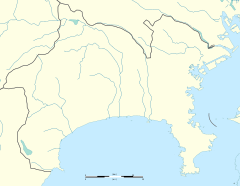
| Location | 2 Suehirochō, Tsurumi, Yokohama, Kanagawa (横浜市鶴見区末広町2丁目) Japan | ||||||||||||||
| Operated by | |||||||||||||||
| Line(s) | JI Tsurumi Line | ||||||||||||||
| History | |||||||||||||||
| Opened | 30 March 1926 | ||||||||||||||
| Passengers | |||||||||||||||
| FY2006 | 876 daily | ||||||||||||||
| Services | |||||||||||||||
| |||||||||||||||
| |||||||||||||||
Asano Station (浅野駅, Asano-eki) is a railway station on the Tsurumi Line in Tsurumi-ku, Yokohama, Kanagawa Prefecture, Japan, operated by East Japan Railway Company (JR East).
Lines
[edit]Asano Station is served by the Tsurumi Line, and forms a junction between the Tsurumi Main Line and Umi-Shibaura Branch Line. It is located 3.0 kilometers (1.9 mi) from the western terminus at Tsurumi Station.
Station layout
[edit]Asano Station has an island platform (platforms 1 and 2) and two opposed side platforms (platforms 3 and 4) serving four tracks.
Platforms
[edit]| 1 | JI Tsurumi Line (Main Line) |
for Hama-Kawasaki, Ōgimachi, and Ōkawa |
| 2 | JI Tsurumi Line (Main Line) |
for Bentembashi and Tsurumi |
| 3 | JI Tsurumi Line (Umi-Shibaura Branch) |
for Umi-Shibaura |
| 4 | JI Tsurumi Line (Umi-Shibaura Branch) |
for Bentembashi and Tsurumi |
-
The Tsurumi Line mainline platforms (1 and 2), June 2015
-
The Umi-Shibaura Branch Line platforms (3 and 4), June 2015
History
[edit]The station opened on 10 March 1926, on the privately owned Tsurumi Rinkō Railway (鶴見臨港鉄道, Tsurumi Rinkō Tetsudō). The Tsurumi Rinkō line was nationalized on 1 July 1943, and was later absorbed into the Japanese National Railways (JNR) network. The station has been unstaffed since 1 March 1971.[citation needed] Upon the privatization of JNR on 1 April 1987, the station has been operated by JR East.
See also
[edit]References
[edit]- Harris, Ken and Clarke, Jackie. Jane's World Railways 2008-2009. Jane's Information Group (2008). ISBN 0-7106-2861-7
External links
[edit]- JR East Asano Station (in Japanese)


