This article includes a list of references, related reading, or external links, but its sources remain unclear because it lacks inline citations. (July 2019) |
This article may rely excessively on sources too closely associated with the subject, potentially preventing the article from being verifiable and neutral. (May 2024) |

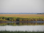
The Ashepoo Combahee Edisto Basin National Estuarine Research Reserve (often shortened to ACE Basin NERR) is a 140,000-acre (570 km2) reserve area located in the ACE Basin, one of the largest undeveloped estuaries on the Atlantic coast of the United States.[citation needed] It is named for the Ashepoo, Combahee and Edisto Rivers, which flow past cypress swamps, historic plantation houses, old rice fields and tidal marshes to meet at South Carolina's biologically rich St. Helena Sound.
The ACE Basin NERR is intended to protect the natural environment, wildlife and cultural heritage of the area.[citation needed] The reserve also preserves the habitat of a number of endangered or threatened species, such as shortnose sturgeon, wood storks, loggerhead sea turtles and bald eagles.
Commercial fisherman harvest supplies of shrimp, crab, oyster, clam and finfish each year in the ACE Basin. Recreational fishermen ply the mudflats for spottail bass, flounder and shrimp, while paddlers visit the salt marsh creeks and the black waters of the rivers.[citation needed]
Research conducted at the ACE Basin NERR enhance the protection of these commercial and recreational uses by monitoring water quality, providing information on the number and types of plant and animal species, and evaluating the overall health of the ACE Basin ecosystem.[citation needed]
Through a number of educational programs, the reserve provides information to coastal decision makers, lawmakers, teachers, students and the general public.[citation needed] The reserve sponsors a summer lecture series, develops curriculum materials for teachers, offers a touch tank program for children and conducts educational cruises where students and teachers learn about estuaries and their values to marine, avian and human life.
References
[edit]- Ashepoo Combahee Edisto Basin National Estuarine Research Reserve
- ACE Basin at the National Oceanic and Atmospheric Administration
![]() This article incorporates public domain material from websites or documents of the NOAA.
This article incorporates public domain material from websites or documents of the NOAA.
32°29′N 80°26′W / 32.483°N 80.433°W
