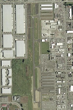
Auburn Municipal Airport Dick Scobee Field | |||||||||||
|---|---|---|---|---|---|---|---|---|---|---|---|
 | |||||||||||
| Summary | |||||||||||
| Airport type | Public | ||||||||||
| Owner | City of Auburn | ||||||||||
| Operator | Airport Management Group | ||||||||||
| Serves | Auburn, Washington | ||||||||||
| Location | Auburn, Washington | ||||||||||
| Elevation AMSL | 63 ft / 19 m | ||||||||||
| Coordinates | 47°19′39″N 122°13′35″W / 47.32750°N 122.22639°W | ||||||||||
| Website | auburnmunicipalairport | ||||||||||
| Map | |||||||||||
 | |||||||||||
| Runways | |||||||||||
| |||||||||||
| Statistics | |||||||||||
| |||||||||||
Auburn Municipal Airport (FAA LID: S50) is two miles north of downtown Auburn, in King County, Washington.[1]
The airport is referred to as Dick Scobee Field, after Francis "Dick" Scobee, an Auburn and Washington native who was the commander astronaut for the Space Shuttle Challenger. Scobee was killed in the 1986 Challenger disaster.
The Federal Aviation Administration (FAA) National Plan of Integrated Airport Systems for 2017–2021 categorized it as a regional reliever facility.[2]
Facilities
[edit]The airport covers 110 acres (45 ha) and has one asphalt runway.[1] It has no scheduled airline service. In the year ending December 31, 2019, 264 aircraft were based at Auburn, including 240 single engine, 15 multi-engine aircraft, 7 helicopters, and 2 gliders. In 2019, the airport averaged 383 operations per day.[1][3]
The closest commercial airport outside of Auburn, Washington is Seattle-Tacoma International Airport, 8 nautical miles (15 km; 9.2 mi) northwest, in SeaTac, Washington.
See also
[edit]References
[edit]- ^ a b c d FAA Airport Form 5010 for S50 PDF, effective August 10, 2023
- ^ "List of NPIAS Airports" (PDF). FAA.gov. Federal Aviation Administration. 21 October 2016. Retrieved 23 November 2016.
External links
[edit]- Auburn Municipal Airport (official site)
- City of Auburn, Washington
- Resources for this airport:
- FAA airport information for S50
- AirNav airport information for S50
- FlightAware airport information and live flight tracker
- SkyVector aeronautical chart for S50

