You can help expand this article with text translated from the corresponding article in Russian. (March 2024) Click [show] for important translation instructions.
|
Dolgoprudny
Долгопрудный | |
|---|---|
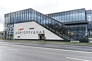
 A street in Dolgoprudny in 2016 | |
| Coordinates: 55°56′N 37°30′E / 55.933°N 37.500°E | |
| Country | Russia |
| Federal subject | Moscow Oblast[1] |
| Founded | 1931 |
| Town status since | 1957 |
| Government | |
| • Head | Vladislav Yudin |
| Elevation | 180 m (590 ft) |
| Population | |
| • Total | 90,956 |
| • Rank | 187th in 2010 |
| • Subordinated to | Dolgoprudny Town Under Oblast Jurisdiction[1] |
| • Capital of | Dolgoprudny Town Under Oblast Jurisdiction[1] |
| • Urban okrug | Dolgoprudny Urban Okrug[3] |
| • Capital of | Dolgoprudny Urban Okrug[3] |
| Time zone | UTC+3 (MSK |
| Postal code(s)[5] | 141700 |
| Dialing code(s) | +7 495 |
| OKTMO ID | 46716000001 |
| Website | www |
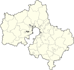
Dolgoprudny (Russian: Долгопру́дный, Russian pronunciation: [dəlɡɐˈprudnɨj]) is a town in Moscow Oblast, Russia, located about 20 kilometers (12 mi) north of Moscow city center. The town's name is derived from Russian "Долгий пруд" (dolgy prud, lit. "long pond")—a long and narrow pond situated in the northeastern part of the town. The town's name is sometimes colloquially shortened as Dolgopa. Population: 120,907 (2021 Census);[6] 90,956 (2010 Census);[2] 68,792 (2002 Census);[7] 70,751 (1989 Soviet census).[8]
Geography
[edit]The territory of the town borders with Moscow in the south and in the east, Khimki in the southwest, and is limited by the Moscow Canal in the west and by the Klyazminskoye Reservoir in the north. The town can be reached by suburban train from the Savyolovsky Terminal of Moscow in about twenty minutes to one of the three platforms: Novodachnaya, Dolgoprudnaya, or Vodniki, or by bus shuttle from Khovrino and Altufyevo stations of the Moscow Metro. The Dmitrovskoye highway connecting Moscow with Dmitrov and Dubna passes just east of the town.
History
[edit]
A settlement of Vinogradovo situated in the place of the modern town was known at least since the 17th century. Then a railway was built in the 1900s (decade) and a railway platform was built in 1914. The settlement started to develop as an airship manufacturing plant was built there in 1931. The aeronautic engineer Umberto Nobile worked there for five years during the 1930s. For a few years during the 1930s, the settlement was renamed Dirizhablestroy (meaning "airship building"). In 1951, the famous Moscow Institute of Physics and Technology or Phystech, moved to Dolgoprudny, and a construction of its present campus started in the southern part of the town, inspired by the Nobel Prize winners Pyotr Kapitsa, Lev Landau, and Nikolay Semyonov. Town status was granted in 1957.[citation needed]
Administrative and municipal status
[edit]Within the framework of administrative divisions, it is incorporated as Dolgoprudny Town Under Oblast Jurisdiction—an administrative unit with the status equal to that of the districts.[1] As a municipal division, Dolgoprudny Town Under Oblast Jurisdiction is incorporated as Dolgoprudny Urban Okrug.[3]
Economy
[edit]Now the town has machinery-building, engineering, and chemical industries. It is being extensively developed with much commercial and residential construction due to its favorable location and following the growing demand for real estate in the suburbs of Moscow.
Gallery
[edit]-
Church of the Theotokos of Kazan
-
The campus of the Moscow Institute of Physics and Technology (Phystech)
References
[edit]Notes
[edit]- ^ a b c d e Law #11/2013-OZ
- ^ a b Russian Federal State Statistics Service (2011). Всероссийская перепись населения 2010 года. Том 1 [2010 All-Russian Population Census, vol. 1]. Всероссийская перепись населения 2010 года [2010 All-Russia Population Census] (in Russian). Federal State Statistics Service.
- ^ a b c Law #56/2005-OZ
- ^ "Об исчислении времени". Официальный интернет-портал правовой информации (in Russian). June 3, 2011. Retrieved January 19, 2019.
- ^ Почта России. Информационно-вычислительный центр ОАСУ РПО. (Russian Post). Поиск объектов почтовой связи (Postal Objects Search) (in Russian)
- ^ Russian Federal State Statistics Service. Всероссийская перепись населения 2020 года. Том 1 [2020 All-Russian Population Census, vol. 1] (XLS) (in Russian). Federal State Statistics Service.
- ^ Federal State Statistics Service (May 21, 2004). Численность населения России, субъектов Российской Федерации в составе федеральных округов, районов, городских поселений, сельских населённых пунктов – районных центров и сельских населённых пунктов с населением 3 тысячи и более человек [Population of Russia, Its Federal Districts, Federal Subjects, Districts, Urban Localities, Rural Localities—Administrative Centers, and Rural Localities with Population of Over 3,000] (XLS). Всероссийская перепись населения 2002 года [All-Russia Population Census of 2002] (in Russian).
- ^ Всесоюзная перепись населения 1989 г. Численность наличного населения союзных и автономных республик, автономных областей и округов, краёв, областей, районов, городских поселений и сёл-райцентров [All Union Population Census of 1989: Present Population of Union and Autonomous Republics, Autonomous Oblasts and Okrugs, Krais, Oblasts, Districts, Urban Settlements, and Villages Serving as District Administrative Centers]. Всесоюзная перепись населения 1989 года [All-Union Population Census of 1989] (in Russian). Институт демографии Национального исследовательского университета: Высшая школа экономики [Institute of Demography at the National Research University: Higher School of Economics]. 1989 – via Demoscope Weekly.
Sources
[edit]- Московская областная Дума. Закон №11/2013-ОЗ от 31 января 2013 г. «Об административно-территориальном устройстве Московской области», в ред. Закона №249/2019-ОЗ от 29 ноября 2019 г. «О внесении изменений в Закон Московской области "Об административно-территориальном устройстве Московской области"». Вступил в силу на следующий день после официального опубликования (13 января 2013 г.). Опубликован: "Ежедневные Новости. Подмосковье", №24, 12 февраля 2013 г. (Moscow Oblast Duma. Law #11/2013-OZ of January 31, 2013 On the Administrative-Territorial Structure of Moscow Oblast, as amended by the Law #249/2019-OZ of November 29, 2019 On amending the Law of Moscow Oblast "On the Administrative-Territorial Structure of Moscow Oblast". Effective as of the day following the day of the official publication (January 13, 2013).).
- Московская областная Дума. Закон №56/2005-ОЗ от 25 февраля 2005 г. «О статусе и границе городского округа Долгопрудный», в ред. Закона №20/2012-ОЗ от 23 марта 2012 г «О внесении изменений в Закон Московской области "О статусе и границе городского округа Долгопрудный"». Вступил в силу со дня официального опубликования. Опубликован: "Ежедневные Новости. Подмосковье", №40–41, 5 марта 2005 г. (Moscow Oblast Duma. Law #56/2005-OZ of February 25, 2005 On the Status and the Border of Dolgoprudny Urban Okrug, as amended by the Law #20/2012-OZ of March 23, 2012 On Amending the Law of Moscow Oblast "On the Status and the Border of Dolgoprudny Urban Okrug". Effective as of the day of the official publication.).
External links
[edit] Media related to Dolgoprudny at Wikimedia Commons
- Official website of Dolgoprudny (in Russian)
- Dolgoprudny Business Directory (in Russian)


