Hato Rey Central | |
|---|---|
 Polytechnic University of Puerto Rico and the Milla de Oro in the background. | |
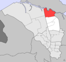
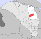
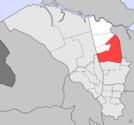
 Location of Hato Rey Central shown in yellow. | |
| Coordinates: 18°25′19″N 66°03′02″W / 18.421854°N 66.05052°W[1] | |
| Commonwealth | |
| Municipality | |
| Area | |
• Total | 1.04 sq mi (2.7 km2) |
| • Land | 1.03 sq mi (2.7 km2) |
| • Water | 0.01 sq mi (0.03 km2) |
| Elevation | 23 ft (7 m) |
| Population (2010) | |
• Total | 16,640 |
| • Density | 16,155.3/sq mi (6,237.6/km2) |
| 2010 census | |
| ZIP code | 00917 |
Hato Rey Central is one of the 18 barrios of the municipality of San Juan, Puerto Rico. It is one of three barrios formerly known as Hato Rey. With a population density of 16,155.3 per square mile. It has a land area of 1.03 sq mi and a 2010 Census population of 16,640.[3]
Hato Rey Central was a barrio of the former municipality of Rio Piedras, before it was merged with San Juan in 1951.
It is bounded by Hato Rey Norte to the west, by barrio Universidad to the south, by Oriente to the east, and by Santurce to the north. The Caño Martín Peña separates Hato Rey Central from Santurce.
Demographics
[edit]| Census | Pop. | Note | %± |
|---|---|---|---|
| 1950 | 27,327 | — | |
| 1960 | 28,745 | 5.2% | |
| 1970 | 28,327 | −1.5% | |
| 1980 | 23,246 | −17.9% | |
| 1990 | 22,504 | −3.2% | |
| 2000 | 20,867 | −7.3% | |
| 2010 | 16,640 | −20.3% | |
| U.S. Decennial Census 1900 (N/A)[4] 1910-1930[5] 1930-1950[6] 1980-2000[7] 2010[8] | |||
The population of the barrio is of 16,640, with a population density of 16,155 residents per square mile.[3]
Districts
[edit]The barrio of Hato Rey Central is further divided into 4 subbarrios,[9] from north to south:[10]
-
 Las Monjas
 -
 Ciudad Nueva
 -
-
 Quintana
.png)
.png)
.png)
.png)
Landmarks and places of interest
[edit]- Martín Peña Bridge (shared with Hato Rey Norte), Art Deco-style bridge that connects Hato Rey Central with Santurce.
- Milla de Oro, the central business district of San Juan.
- Polytechnic University of Puerto Rico's main campus.
Transportation
[edit]Although none of the Tren Urbano stations are technically located in Hato Rey Central, the Piñero, Domenech, Roosevelt and Hato Rey metro stations are located very close (in some cases even steps away) to the barrio. The area is also served by the Metropolitan Bus Authority (AMA).
Gallery
[edit]-
 Las Monjas district.
 -
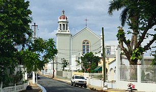 Espiritu Santo Parish in Floral Park district.
 -
 Polytechnic University Library


See also
[edit]References
[edit]- ^ a b "US Gazetteer 2019". US Census. US Government.
- ^ U.S. Geological Survey Geographic Names Information System: Hato Rey Central barrio
- ^ a b Puerto Rico: 2010:population and housing unit counts (PDF). U.S. Dept. of Commerce, Economics and Statistics Administration, U.S. Census Bureau. 2010.
- ^ "Report of the Census of Porto Rico 1899". War Department Office Director Census of Porto Rico. Archived from the original on July 16, 2017. Retrieved September 21, 2017.
- ^ "Table 3-Population of Municipalities: 1930 1920 and 1910" (PDF). United States Census Bureau. Archived (PDF) from the original on August 17, 2017. Retrieved September 21, 2017.
- ^ "Table 4-Area and Population of Municipalities Urban and Rural: 1930 to 1950" (PDF). United States Census Bureau. Archived (PDF) from the original on August 30, 2015. Retrieved September 21, 2014.
- ^ "Table 2 Population and Housing Units: 1960 to 2000" (PDF). United States Census Bureau. Archived (PDF) from the original on July 24, 2017. Retrieved September 21, 2017.
- ^ Puerto Rico: 2010 Population and Housing Unit Counts.pdf (PDF). U.S. Dept. of Commerce Economics and Statistics Administration U.S. Census Bureau. 2010. Archived (PDF) from the original on 2017-02-20. Retrieved 2019-08-02.
- ^ "US Census definition of "subbarrio"". factfinder.com. US Census. Archived from the original on 12 February 2019. Retrieved 5 January 2019.
- ^ "Archived copy" (PDF). Archived from the original (PDF) on 2017-07-24. Retrieved 2019-02-11.
{{cite web}}: CS1 maint: archived copy as title (link)
City of San Juan, Puerto Rico | ||
|---|---|---|
| Barrios |  | |
This San Juan, Puerto Rico location article is a stub. You can help Wikipedia by expanding it. |