| Hidakasanmyaku-Erimo-Tokachi National Park | |
|---|---|
| 日高山脈襟裳十勝国立公園 | |
 A view from Mount Poroshiri | |
| Location | Hokkaidō, Japan |
| Coordinates | 42°23′19″N 142°57′6″E / 42.38861°N 142.95167°E |
| Area | 2,456.68 km2 (948.53 sq mi) |
| Established | 25 June 2024[1] |
| Governing body | Ministry of the Environment (Japan) |
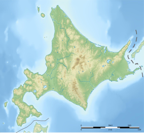
Hidakasanmyaku-Erimo-Tokachi National Park (日高山脈襟裳十勝国立公園, Hidaka-sanmyaku-Erimo-Tokachi Kokuritsu-kōen) is a national park in south-central Hokkaido, Japan. Encompassing much of the Hidaka Mountains as well as Cape Erimo, it is the largest in the country by land area.[2][1]
History
[edit]Erimo Prefectural Park was first established in 1950, before its redesignation as Erimo Prefectural Natural Park in 1958.[3] On 1 October 1981, the park was elevated to the status of a quasi-national park and renamed Hidaka-sanmyaku Erimo Quasi-National Park (日高山脈襟裳国定公園).[3] On 25 June 2024, the park was once again elevated in status and renamed Hidakasanmyaku-Erimo-Tokachi National Park.[4][1] At the same time, the area designated for protection was increased from 1,034.47 square kilometres (399.41 sq mi) to 2,456.68 square kilometres (948.53 sq mi).[2]
Related municipalities
[edit]The park includes areas of:[2]
- Biratori
- Erimo
- Hidaka
- Hiroo
- Memuro
- Nakasatsunai
- Niikappu
- Obihiro
- Samani
- Shimizu
- Shinhidaka
- Taiki
- Urakawa
See also
[edit]References
[edit]- ^ a b c "The 35th National Park "Hidakasanmyaku-Erimo-Tokachi National Park" was born!". Ministry of the Environment. 25 June 2024. Retrieved 9 July 2024.
- ^ a b c 日高山脈襟裳十勝国立公園の指定概要 [Designation of Hidakasanmyaku-Erimo-Tokachi National Park: Overview] (PDF) (in Japanese). Ministry of the Environment. Retrieved 9 July 2024.
- ^ a b 日高山脈襟裳国定公園 [Hidaka-sanmyaku Erimo Quasi-National Park] (in Japanese). Hokkaido. Retrieved 9 July 2024.
- ^ 35か所目となる国立公園「日高山脈襟裳十勝国立公園」が誕生しました! [The 35th National Park "Hidakasanmyaku-Erimo-Tokachi National Park" was born!] (in Japanese). Ministry of the Environment. 25 June 2024. Retrieved 9 July 2024.


