Jacksonville, Pennsylvania | |
|---|---|
_Church_along_PA_Route_26.jpg) Emmanuel United Church of Christ | |
 Map showing Centre County in Pennsylvania | |
 Jacksonville Map showing Jacksonville in Centre County  Jacksonville Jacksonville (the United States) | |
| Coordinates: 40°59′32″N 77°37′55″W / 40.99222°N 77.63194°W | |
| Country | United States |
| State | Pennsylvania |
| County | Centre |
| Township | Marion |
| Area | |
• Total | 0.14 sq mi (0.37 km2) |
| • Land | 0.14 sq mi (0.37 km2) |
| • Water | 0.0 sq mi (0.0 km2) |
| Elevation | 902 ft (275 m) |
| Population (2010) | |
• Total | 95 |
| • Density | 668/sq mi (258.1/km2) |
| Time zone | UTC-5 (Eastern (EST)) |
| • Summer (DST) | UTC-4 (EDT) |
| FIPS code | 42-37545 |
| GNIS feature ID | 2584473 |
Jacksonville is an unincorporated American community and census-designated place[1] that is located in Marion Township, Centre County, Pennsylvania.
As of the 2010 census, the population was 95 residents.[2]
History and geography
[edit]The town is located in the Little Nittany Valley, 10 miles (16 km) northeast of Bellefonte, the Centre County seat.
Howard Gap in Bald Eagle Mountain is located just to the northwest of the town. Pennsylvania Route 26 passes through the gap, leading 2.5 miles (4.0 km) to the borough of Howard. Interstate 80 passes through the Little Nittany Valley just southeast of Jacksonville. Newly added Exit 163 serves Jacksonville and Howard.
Education
[edit]The CDP is in Bellefonte Area School District.[3]
Gallery
[edit]-
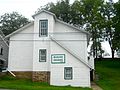 Grange

References
[edit]- ^ "2010 U.S. Census website". United States Census Bureau. Retrieved February 13, 2016.
- ^ "Geographic Identifiers: 2010 Census Summary File 1 (G001): Jacksonville CDP, Pennsylvania". U.S. Census Bureau, American Factfinder. Archived from the original on April 15, 2015. Retrieved April 15, 2015.
- ^ "2020 CENSUS - SCHOOL DISTRICT REFERENCE MAP: Centre County, PA" (PDF). U.S. Census Bureau. Retrieved July 18, 2024. - Text list
