View text source at Wikipedia


List of bridges in Perth, Western Australia

This is a list of major bridges in Perth, Western Australia. Most bridges cross either the Swan River or the Canning River, the two main rivers that traverse the Swan Coastal Plain. Others are overpasses for major roads.

Road bridges

[edit]
Name Image Length Location Coordinates Carries Crosses Notes
Barrack Street Bridge Perth 31°57′07″S 115°51′42″E / 31.95191°S 115.86156°E / -31.95191; 115.86156 (Barrack Street Bridge) Beaufort Street[1] Fremantle railway line
Canning Bridge 175 m (574 ft) ComoApplecross 32°0′39.5″S 115°51′11.5″E / 32.010972°S 115.853194°E / -32.010972; 115.853194 (Canning Bridge) Canning Highway Canning River
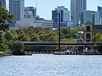
The Causeway 341 m (1,120 ft) East PerthVictoria Park 31°58′0.5″S 115°53′9.6″E / 31.966806°S 115.886000°E / -31.966806; 115.886000 (The Causeway) The Causeway (road) Swan River Comprises two bridges meeting at Heirisson Island
Fremantle Traffic Bridge 230 m (750 ft) North FremantleFremantle 32°02′28″S 115°45′17″E / 32.0410°S 115.7546°E / -32.0410; 115.7546 (Fremantle Traffic Bridge) Queen Victoria Street Swan River
Garratt Road Bridge 240 m (790 ft) BayswaterAscot 31°55′57″S 115°54′59″E / 31.9324°S 115.9164°E / -31.9324; 115.9164 (Garratt Road Bridge) Garratt Road Swan River
Horseshoe Bridge 280 m (920 ft) Perth 31°57′3″S 115°51′34″E / 31.95083°S 115.85944°E / -31.95083; 115.85944 (Horseshoe Bridge) William Street Fremantle railway line
Mooro-Beeloo Bridge 271 m (889 ft) BayswaterRedcliffe 31°55′48.7″S 115°56′13.3″E / 31.930194°S 115.937028°E / -31.930194; 115.937028 (Redcliffe Bridge) Tonkin Highway Swan River Known as Redcliffe Bridge until December 2023
Mount Henry Bridge 660 m (2,170 ft) Salter PointBrentwood 32°2′0″S 115°51′31″E / 32.03333°S 115.85861°E / -32.03333; 115.85861 (Mount Henry Bridge) Kwinana Freeway Canning River Also a railway bridge
Narrows Bridge 397 m (1,302 ft) PerthSouth Perth 31°57′48″S 115°50′49″E / 31.96333°S 115.84694°E / -31.96333; 115.84694 (Narrows Bridge) Kwinana Freeway Swan River Three parallel bridges; also a railway bridge
Riverton Bridge 100 m (330 ft) RivertonWilson 32°1′40.2″S 115°54′4.75″E / 32.027833°S 115.9013194°E / -32.027833; 115.9013194 (Riverton Bridge) Fern Road Canning River
Shelley Bridge 240 m (790 ft) ShelleyWilson 32°01′25″S 115°54′06″E / 32.0237°S 115.9017°E / -32.0237; 115.9017 (Shelley Bridge) Leach Highway Canning River
Stirling Bridge 400 m (1,300 ft) North FremantleEast Fremantle 32°02′21″S 115°45′33″E / 32.0392°S 115.7593°E / -32.0392; 115.7593 (Stirling Bridge) Stirling Highway Swan River
Walley Bridge 61 m (200 ft) WellardBaldivis 32°16′18″S 115°50′42″E / 32.2718°S 115.8451°E / -32.2718; 115.8451 (Walley Bridge) Kwinana Freeway Millar Road, Rail Line 13
Windan Bridge 406 m (1,332 ft) East PerthBurswood 31°56′51″S 115°52′58″E / 31.9474°S 115.8828°E / -31.9474; 115.8828 (Windan Bridge) Graham Farmer Freeway Swan River Runs alongside Goongoongup Bridge

Railway bridges

[edit]
Name Image Location Coordinates Carries Crosses Notes
Bunbury Bridge East Perth 31°56′53″S 115°52′58″E / 31.94794°S 115.88286°E / -31.94794; 115.88286 (Bunbury Bridge) Swan River 1930 to 1996
Goongoongup Bridge East Perth – Burswood 31°56′52″S 115°52′58″E / 31.9477°S 115.8829°E / -31.9477; 115.8829 (Goongoongup Bridge) Armadale and Thornlie railway lines Swan River 1995 to present
Mount Henry Bridge Salter Point – Brentwood 32°2′0″S 115°51′31″E / 32.03333°S 115.85861°E / -32.03333; 115.85861 (Mount Henry Bridge) Mandurah railway line Canning River
Narrows Bridge Perth – South Perth 31°57′48″S 115°50′49″E / 31.96333°S 115.84694°E / -31.96333; 115.84694 (Narrows Bridge) Mandurah railway line Swan River

Pedestrian bridges

[edit]
Name Image Location Coordinates Crosses Notes
Boorloo Bridge East Perth – Victoria Park Swan River Under construction[2]
Elizabeth Quay Bridge Perth 31°57′33″S 115°51′21″E / 31.95923°S 115.85581°E / -31.95923; 115.85581 (Elizabeth Quay Bridge) Elizabeth Quay
Matagarup Bridge East Perth 31°57′14″S 115°53′06″E / 31.954°S 115.885°E / -31.954; 115.885 (Matagarup Bridge) Swan River
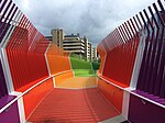
The Kids' Bridge Nedlands Winthrop Avenue
Trafalgar Bridge East Perth 31°57′07″S 115°52′49″E / 31.95193°S 115.88022°E / -31.95193; 115.88022 (Trafalgar Bridge) Claisebrook Cove

See also

[edit]

References

[edit]
  1. ^ Main Roads Western Australia. Road Information Mapping System (Map). Government of Western Australia. Structure Number 0949A. Retrieved 1 May 2019.
  2. ^ Ford, Olivia (4 August 2024). "Perth's CBD 'Gateway' set to be unveiled by end of 2024". The West Australian. Retrieved 5 August 2024.

General references

[edit]
[edit]