| Matcham Central Coast, New South Wales | |||||||||||||||
|---|---|---|---|---|---|---|---|---|---|---|---|---|---|---|---|
 | |||||||||||||||
 | |||||||||||||||
| Population | 987 (2016 census)[1] | ||||||||||||||
| • Density | 240.7/km2 (623/sq mi) | ||||||||||||||
| Postcode(s) | 2250 | ||||||||||||||
| Elevation | 32 m (105 ft) | ||||||||||||||
| Area | 4.1 km2 (1.6 sq mi) | ||||||||||||||
| Location |
| ||||||||||||||
| LGA(s) | Central Coast Council | ||||||||||||||
| Parish | Kincumber | ||||||||||||||
| State electorate(s) | Terrigal | ||||||||||||||
| Federal division(s) | Dobell | ||||||||||||||
| |||||||||||||||
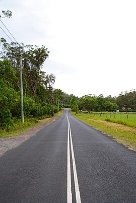
Matcham is a semi-rural suburb of the Central Coast region of New South Wales, Australia. It is part of the Central Coast Council local government area and included in the electoral district of Terrigal.[2] It has a hall and a historic church, St. George's Church, established in 1925.[citation needed]
Origin of the name Matcham
[edit]The Matcham Estate was a grant of 2,560 acres to Charles Horatio Nelson Matcham, a nephew of Lord Horatio Nelson, 1st Viscount Nelson. Charles Horatio Matcham came to Sydney in 1828.
Charles Matcham of the Murrumbidgee River was promised the land as a primary grant and authorised to take possession from 18 October 1831. The deed is registered in book 59/129 and is dated 1 January 1840.
He remained at "Bogolong" Murrumbidgee, where he died on 11 March 1844.
The estate passed to his nephew and then through various hands without development until 1907, when George Matcham sold to Frank L Measures of Niagara Park. Between 1907 and 1910, Measures subdivided the estate into various portions, one of them eventually becoming the suburb of nearby Holgate.
Extracted from the Matcham and Holgate Hall News (Matcham Hall).
Notable people
[edit]Notable residents include Peter Sterling.
References
[edit]- ^ Australian Bureau of Statistics (27 June 2017). "Matcham (State Suburb)". 2016 Census QuickStats. Retrieved 19 March 2018.
- ^ "Electoral District of Terrigal". elections.nsw.gov.au. Retrieved 30 January 2019.
![]() Media related to Matcham, New South Wales at Wikimedia Commons
33°24′54″S 151°25′34″E / 33.415°S 151.426°E
Media related to Matcham, New South Wales at Wikimedia Commons
33°24′54″S 151°25′34″E / 33.415°S 151.426°E