Metrogorodok | |
|---|---|
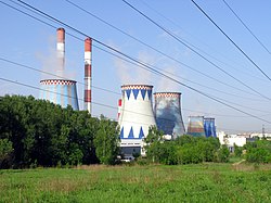
 CHP-23 power station, Metrogorodok District | |
 Location of Metrogorodok District on the map of Moscow | |
| Coordinates: 55°50′19″N 37°44′54″E / 55.83861°N 37.74833°E | |
| Country | Russia |
| Federal subject | Moscow |
| Area | |
| • Total | 27.57 km2 (10.64 sq mi) |
| Time zone | UTC+3 (MSK |
| OKTMO ID | 45311000 |
| Website | http://metrogorodok.mos.ru/ |
Metrogorodok District (Russian: район Метрогородок) is the northernmost administrative district[3] (55° 50' 19.26" 37° 44' 55.32"E) (raion) of Eastern Administrative Okrug, and one of the 125 raions of Moscow, Russia.[4]
The district has a size of 27.57 square kilometers (10.64 sq mi).[1] 90% of the Metrogorodok's area is occupied by the Losiny Ostrov National Park. Despite that fact, the ecological situation is assessed as unfavorable because of the Kaloshino industrial zone, combined heat and power station No. 23 and felling of forest zones.[5]
The municipality got its name from the metro builders settlement, which arose in the 1930s during the construction of the first stage of the Moscow metro.[6]
See also
[edit]References
[edit]Notes
[edit]- ^ a b "General Information" (in Russian). Metrogorodok District. Retrieved March 27, 2018.
- ^ "Об исчислении времени". Официальный интернет-портал правовой информации (in Russian). 3 June 2011. Retrieved 19 January 2019.
- ^ http://vao.mos.ru/stroitelstvo-v-okruge/stroitelstvo_v_raionah/metrogorodok/
- ^ Государственный комитет Российской Федерации по статистике. Комитет Российской Федерации по стандартизации, метрологии и сертификации. №ОК 019-95 1 января 1997 г. «Общероссийский классификатор объектов административно-территориального деления. Код 45», в ред. изменения №278/2015 от 1 января 2016 г.. (State Statistics Committee of the Russian Federation. Committee of the Russian Federation on Standardization, Metrology, and Certification. #OK 019-95 January 1, 1997 Russian Classification of Objects of Administrative Division (OKATO). Code 45, as amended by the Amendment #278/2015 of January 1, 2016. ).
- ^ "ЭКОЛОГИЯ РАЙОНА МЕТРОГОРОДОК". Archived from the original on 2017-08-04. Retrieved 2017-08-03.
- ^ "История района Метрогородок". Archived from the original on 2017-08-03. Retrieved 2017-08-03.
Sources
[edit]55°50′19″N 37°44′54″E / 55.83861°N 37.74833°E

