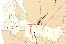
| Northgate Adelaide, South Australia | |||||||||||||||
|---|---|---|---|---|---|---|---|---|---|---|---|---|---|---|---|
 | |||||||||||||||
| Coordinates | 34°51′28″S 138°37′50″E / 34.857840°S 138.630450°E | ||||||||||||||
| Population | 3,184 (SAL 2021)[1] | ||||||||||||||
| Established | 2000 | ||||||||||||||
| Postcode(s) | 5085 | ||||||||||||||
| Location | 8 km (5 mi) from Adelaide | ||||||||||||||
| LGA(s) | City of Port Adelaide Enfield | ||||||||||||||
| State electorate(s) | Enfield | ||||||||||||||
| Federal division(s) | Adelaide | ||||||||||||||
| |||||||||||||||
| Footnotes | Coordinates, adjacent suburbs, electorates[2] | ||||||||||||||
Northgate is a suburb in the inner north-east of Adelaide, South Australia. It is approximately a 10-minute drive from the Adelaide City Council.
Until March 2016, Northgate also included a significant portion of what is now Lightsview.[3]
Places of interest
[edit]Shopping
[edit]The Northgate Village Shopping Centre is located on the corner of Fosters Road and Folland Avenue and contains a Woolworths supermarket and some specialty stores.
Transport
[edit]Main roads within Northgate which are major public transport routes are:
- Grand Junction Road: Routes 237 and 361
- Fosters Road: Routes 204, 208, 206 and 528
Main North Road and Hampstead Road are major arterial roads, in very close proximity to Northgate, with both having bus services supplying those roads.
The O-Bahn Busway is also close to Northgate, with Adelaide Metro providing a bus service that links the Adelaide city centre, the O-Bahn and Northgate.[4]
The Northfield railway line was located nearby but was closed in 1987.
See also
[edit]References
[edit]- ^ Australian Bureau of Statistics (28 June 2022). "Northgate (SA) (suburb and locality)". Australian Census 2021 QuickStats. Retrieved 28 June 2022.
- ^ "Placename Details: Northgate". Property Location Browser. Government of South Australia. SA0048769. Archived from the original on 12 October 2016. Retrieved 30 April 2016.
- ^
- Stephen Mullighan (7 April 2016). "Geographical Names Act 1991 – Notice to Alter the Boundaries of Places and Assign a Name and Boundary to a Place" (PDF). Government Gazette. Government of South Australia. p. 1119 (PDF page 7). Retrieved 30 April 2016.
- New Suburb of Lightsview (PDF) (Map). Government of South Australia. Retrieved 30 April 2016.
- ^ "528". 16 March 2021.
External links
[edit] Media related to Northgate, South Australia at Wikimedia Commons
- City of Port Adelaide Enfield
