Puerto Lumbreras | |
|---|---|
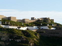
 Castle of Nogalte | |
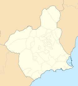
 Location in Murcia | |
| Coordinates: 37°33′48″N 1°48′26″W / 37.56333°N 1.80722°W | |
| Country | |
| Autonomous Community | |
| Province | |
| Comarca | Alto Guadalentín |
| Own municipality | 1958[1] |
| Government | |
| • Mayor | María Ángeles Túnez García (PP) |
| Area | |
| • Total | 338 km2 (131 sq mi) |
| Elevation (AMSL) | 465 m (1,526 ft) |
| Population (2018)[2] | |
| • Total | 14,981 |
| • Density | 44/km2 (110/sq mi) |
| Time zone | UTC+1 (CET) |
| • Summer (DST) | UTC+2 (CEST (GMT +2)) |
| Postal code | 30890 |
| Area code | +34 (Spain) + 968 (Murcia) |
| Website | Official website |
Puerto Lumbreras (Spanish: [ˈpweɾto lumˈbɾeɾas]) is a Spanish municipality in the autonomous community of Murcia. It has a population of 15,780 (2020) and an area of 139 km2 . It is located in the southwestern end of Region of Murcia and is adjacent to Andalusia.
History
[edit]The municipality has been inhabited by human beings since the Upper Palaeolithic.[3] There was also human occupancy during the Bronze Age, specifically by people belonging to the argaric culture.[4][5] During the Roman Hispania era, this current municipality was also inhabited by people.[6] There was also human presence in Puerto Lumbreras during the Islamic Iberian Peninsula era in the High Middle Ages.[7]
Geography
[edit]Physical geography
[edit]The western half of the municipality is more raised than the eastern half. The Rambla de Nogalte traverses the territory from the northeastern quarter to the east and also traverses the main town. Part of the western end of the municipality is occupied by two mountains –Cabezo de Jara and Collado de Media Legua. They do not exclusively occur in Puerto Lumbreras and also occupies part of the adjacent municipality, but they mostly occur in this municipality. Part of the south-west end of the territory is occupied by the northern half of Sierra de Enmedio mountain range.[8]
Human geography
[edit]The municipality is demarcated with four districts named diputaciones – Cabezo de la Jara, where 6 people live;[9] Puerto Lumbreras, inhabited by 12,732 people; Esparragal, where 2,907 people live and Puerto Adentro, which has a population of 132.[10][11]
In El Esparragal, the following localities occur: Ermita, where 150 people live; Estación, which has a population of 530; and El Esparragal, which is home to 2,227 people. In Puerto Adentro, the following localities can be found: Góñar, where 47 people reside; and Puerto Adentro, which is inhabited by 85 people. In Puerto Lumbreras, the following localities are present: Las Casicas, which is home to 55 people; and Puerto Lumbreras, where 12,677 reside.[11]
Demographics
[edit]16.22% inhabitants are foreigners – 2.93% are from other countries of Europe, 10.75% are Africans, 2.819% are Americans, and 0.279% are Asians.[12] The table below shows the population trend during the 20th and 21st centuries by the beginning of their decades.[13]
| 1960 | 1970 | 1981 | 1991 | 2001 | 2011 | |
|---|---|---|---|---|---|---|
| Population | 7,205 | 8,046 | 8,560 | 9,961 | 11,331 | 14,502 |
Economy
[edit]35.6% territory is utilised as crop lands[14] and the most widely grown products are almonds, olives and lettuces.[15] 47.82% agreements were written for jobs of the agriculture and fishing sector in 2019 and 45.74% agreements were written for jobs of the service sector.[16]
Facilities
[edit]Healthcare
[edit]Puerto Lumbreras is included in the Health area III (Lorca) of Region of Murcia. Two consultorios (primary care centres with the fewest functions) and one centro de salud (primary care centre) can be seen in the main town.[17]
Education
[edit]The main town hosts 3 early childhood and primary education centres (CEIP) and 1 secondary education centre (IES). Another early childhood and primary education centre is located in El Esparragal.[18]
Main sights
[edit]Some buildings and places with cultural, historic, or environmental special values in Puerto Lumbreras are listed below.[19]
- Castle of Nogalte: It was built during the Islamic Iberian Peninsula era in the High Middle Ages.
- Casa del Cura: It was built in the 18th century. The parcel of Casa del Cura is composed of three elements: a main building, an attached structure and an aljibe (a kind of cistern).[20]
- Casa de Los Duendes and Augusto Vels Museum: The Casa de Los duendes is located in the historic centre of the town and was built in the 19th century. The building is currently used for an exhibition about graphology and other temporary exhibitions. Several workshops and conferences also take place in this building.[21]
- Earth shelters
- Interpretation centre: it is placed in the west of the municipality. This centre addresses issues such as the environment of the area, its landscape, its flora, its fauna and the human beings of the municipality from a historical view.[22]
- Astronomy observatory: it is located in the west of the municipality and was opened in 2001.[23]
- Cabezo de la Jara spot: Cabezo de la Jara is the highest mountain in the municipality and is 1,247 metres high. In the spot the border among Puerto Lumbreras, Vélez-Rubio and Huércal-Overa occurs. A youth hostel is present in the spot as well as the interpretation centre. Several pit caves can also be found in the mountain.[24]
Festivities
[edit]- Patron saint festivity: It is held in the first week of October. An opening address occurs and next a rocket-shaped firework as a festive inaugurating act (this is named chupinazo). A flea market with medieval appearance is placed during the last days of the festive period.[25]
Festivities in other localities
[edit]- Festivity in El Esparragal: It occurs during the first third of December. Some activities such as a fair of equine cattle, a paddle tournament, a flower placement at the Virgin’s altar, a popular race and a pétanque tournament are performed during this festive period.[26]
- Festivity in Goñar: It is held in August.
- Niño de Nápoles Festivity: It is held in the third weekend of January.[27][28]
Gallery
[edit]-
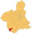
Location of Puerto Lumbreras.
-
Puerto Lumbreras City Office in Doctor Salvador Caballeo Garcia area
-
Picture show by flood damage in Puerto Lumreras in October 1973
References
[edit]- ^ "Historia - Página Web oficial del Ayuntamiento de Puerto Lumbreras".
- ^ Municipal Register of Spain 2018. National Statistics Institute.
- ^ "Resolución 20 de Julio de 2010 de la Dirección General de Bellas Artes y Bienes Culturales por la que se declara bien catalogado por su relevancia cultural el yacimiento arqueológico Cueva del Rayo en Puerto Lumbreras (Murcia)". Sede Electrónica del Boletín Oficial de la Región de Murcia (in Spanish). Retrieved 2021-01-05.
- ^ "PDF del BORM número 70 de 26/03/2011" (in Spanish).
- ^ "Resolución 23 de noviembre de 2010 de la Dirección General de Bellas Artes y Bienes Culturales por la que se declara bien catalogado por su relevancia cultural el yacimiento Arqueológico Vilerda en Puerto Lumbreras (Murcia)". Sede Electrónica del Boletín Oficial de la Región de Murcia. Retrieved 2021-01-06.
- ^ "Publicación número 2731 del BORM número 44 de 23/02/2011 - anuncio.pdf". Sede Electrónica del Boletín Oficial de la Región de Murcia. Retrieved 2021-01-06.
- ^ "Historia de Puerto Lumbreras- Edad Media - Región de Murcia Digital" (in Spanish). Retrieved 2021-01-03.
- ^ "Montes catalogados de Puerto Lumbreras". Murcianatural.
- ^ "CREM - Datos Municipales de Puerto Lumbreras . 1. Evolución de la población según entidades, por sexo. Ambos sexos". Portal Estadístico de la Región de Murcia - CREM.
- ^ "Pedanías de Puerto Lumbreras - Región de Murcia Digital".
- ^ a b "INEbase / Demography and population /Municipal Register. Population by municipality /Nomenclature: Continuous Register Population by Population Unit / Results". INE. Retrieved 2021-02-10.
- ^ "CREM - Datos Municipales Puerto Lumbreras - 5. Evolución de la población según nacionalidad". Portal Estadístico de la Región de Murcia - CREM (in Spanish). Retrieved 2021-01-05.
- ^ "CREM - Datos Municipales Puerto Lumbreras - 1. Censos de Población - Evolución de la población según sexo". Portal Estadístico de la Región de Murcia - CREM (in Spanish). Retrieved 2021-01-05.
- ^ "CREM - Datos Municipales Puerto Lumbreras - 1. Evolución de la distribución general de la tierra". Portal Estadístico de la Región de Murcia - CREM (in Spanish). Retrieved 2021-01-05.
- ^ "CREM - Datos Municipales Puerto Lumbreras - 3. Evolución de la superficie dedicada a cada grupo de cultivo". Portal Estadístico de la Región de Murcia - CREM. 2021-01-05.
- ^ "CREM - Datos Municipales Puerto Lumbreras - 5. Evolución de los contratos de trabajo registrados según sector de actividad económica". Portal Estadístico de la Región de Murcia - CREM. Retrieved 2021-01-05.
- ^ "MurciaSalud, el portalsanitario de la Región de Murcia. Centros Sanitarios" (in Spanish). Retrieved 2021-01-07.
- ^ "Listado de centros". Portal de Transparencia - Región de Murcia (in Spanish). Retrieved 2021-01-07.
- ^ "Puerto Lumbreras : Official Murcia Region tourist site". Retrieved 2021-01-05.
- ^ "Casa del Cura - Página Web oficial del Ayuntamiento de Puerto Lumbreras" (in Spanish). Retrieved 2021-01-05.
- ^ "Casa de los Duendes - Página Web oficial del Ayuntamiento de Puerto Lumbreras" (in Spanish). Retrieved 2021-01-05.
- ^ "Centro de Interpretación - Página web Oficial del Ayuntamiento de Puerto Lumbreras" (in Spanish). Retrieved 2021-01-05.
- ^ "Observatorio Astronómico - Página Web oficial del Ayuntamiento de Puerto Lumbreras" (in Spanish). Retrieved 2021-01-05.
- ^ "Cabezo de la Jara - Página web oficial del Ayuntamiento de Puerto Lumbreras" (in Spanish). Retrieved 2021-02-10.
- ^ "Fiestas Patronales de Puerto Lumbreras 2019 - La Guía W - La Guía Definitiva - Encuentra lo que quieras, donde quieras" (in Spanish).
- ^ "Fiestas El Esparragal 2018 - Página web oficial del Ayuntamiento de Puerto Lumbreras" (in Spanish).
- ^ "Fiestas de Niño de Nápoles - Página Web Oficial del Ayuntamiento de Puerto Lumbreras". 2020-01-18. Retrieved 2021-01-07.
- ^ "Puerto Lumbreras / Puerto Lumbreras acogerá las Fiestas del Niño de Nápoles este fin de semana". Murcia.com (in Spanish). 2018-01-16. Retrieved 2021-01-07.
External links
[edit]- Ayuntamiento de Puerto Lumbreras (in Spanish)
- Business guide and General Information in English and Spanish (in English)


