Regen | |
|---|---|
 | |
| Country | Germany |
| State | Bavaria |
| Adm. region | Lower Bavaria |
| Capital | Regen |
| Government | |
| • District admin. | Rita Röhrl (SPD) |
| Area | |
| • Total | 975 km2 (376 sq mi) |
| Population (31 December 2023)[1] | |
| • Total | 77,940 |
| • Density | 80/km2 (210/sq mi) |
| Time zone | UTC+01:00 (CET) |
| • Summer (DST) | UTC+02:00 (CEST) |
| Vehicle registration | REG, VIT |
| Website | landkreis-regen.de |
Regen is a Landkreis (district) in Bavaria, Germany. It is bounded by (from the south and clockwise) the districts of Freyung-Grafenau, Deggendorf, Straubing-Bogen and Cham, and by the Czech Republic (Plzeň Region).
History
[edit]The district was established in 1972 by merging the former districts of Regen and Viechtach.
Geography
[edit]
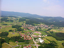
The district is entirely located in the Bavarian Forest. It is named after the Regen river and its two headstreams, the Black Regen and the White Regen.
Coat of arms
[edit]The coat of arms displays:
- the blue and white checked pattern of Bavaria
- a glass, symbolising the glass industry
- a pine tree, symbolising the Bavarian Forest
- a tower, symbolising the castles in the district
Towns and municipalities
[edit]
| Towns | Municipalities | |
|---|---|---|
References
[edit]- ^ Genesis Online-Datenbank des Bayerischen Landesamtes für Statistik Tabelle 12411-003r Fortschreibung des Bevölkerungsstandes: Gemeinden, Stichtag (Einwohnerzahlen auf Grundlage des Zensus 2011).
External links
[edit]Wikimedia Commons has media related to Landkreis Regen.
- Official website (German)


