Tasikmalaya | |
|---|---|
| City of Tasikmalaya Kota Tasikmalaya | |
| Other transcription(s) | |
| • Sundanese | ᮒᮞᮤᮊ᮪ᮙᮜᮚ |
Clockwise from the top: Great Mosque of Tasikmalaya, Wiriadinata Airbase, Tasikmalaya Railway Station | |
| Nickname(s): | |
| Motto(s): | |
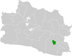
 Location within West Java | |
| Coordinates: 7°18′58″S 108°11′51″E / 7.3161°S 108.1975°E | |
| Country | |
| Region | Java |
| Province | |
| Founded | 2001 |
| Government | |
| • Mayor | Cheka Virgowansyah (Acting) |
| • Vice Mayor | Vacant |
| Area | |
• City | 183.14 km2 (70.71 sq mi) |
| • Metro | 729.4 km2 (281.6 sq mi) |
| Elevation | 340 m (1,120 ft) |
| Population (mid 2023 estimate) | |
• City | 741,760 |
| • Density | 4,100/km2 (10,000/sq mi) |
| • Metro | 1,339,891 |
| • Metro density | 1,800/km2 (4,800/sq mi) |
| [1] | |
| Time zone | UTC+7 (Indonesia Western Time) |
| Area code | (+62) 265 |
| Vehicle registration | Z |
| Website | tasikmalayakota.go.id |
Tasikmalaya is a landlocked city in West Java, Indonesia. The city is sometimes dubbed kota santri (city of religious learners) or "the City of a Thousand Pesantrens" for its abundance of Islamic boarding schools.[2] Located around 120 kilometres (75 mi) southeast from the provincial capital of Bandung, Tasikmalaya is passed by Indonesian National Route 3.
The city is located in the mountainous Priangan region of Java at an elevation of 351 metres (1,151 feet).
The population of the city (excluding the Tasikmalaya Regency, which surrounds the city to the west, south and east) was 634,948 according to the 2010 census,[3] and increased to 716,155 at the 2020 census;[4] the official estimate as at mid 2023 was 741,760 (comprising 375,737 males and 366,023 females).[1] Its built-up (or metro) area (made of Tasikmalaya City and 14 neighbouring districts spread over Tasikmalaya and Ciamis Regencies) was home to 1,214,000 inhabitants as at mid 2023.[5]
Demographics
[edit]The population of the city Tasikmalaya according to the intermediate censuses in the years 2005 and 2015, and the full censuses in 2010[3] and 2020,[4] are listed below:
| Year | Population | Density per km2 |
|---|---|---|
| 2005 | 579,671 | 3,147 |
| 2010 | 634,948 | 3,447 |
| 2015 | 657,477 | 3,569 |
| 2020 | 716,155 | 3,887 |
Administrative districts
[edit]Tasikmalaya city is divided into ten districts (kecamatan), listed below with their areas and their populations at the 2010 census[3] and the 2020 census,[4] together with the official estimates as at mid 2023.[1] The table also includes the number of administrative villages (all classed as urban kelurahan) in each district, and its post code.
| Kode Wilayah |
Name of District (kecamatan) |
Area in km2 |
Pop'n census 2010 |
Pop'n census 2020 |
Pop'n estimate mid 2023 |
No. of villages |
Post codes |
|---|---|---|---|---|---|---|---|
| 32.78.05 | Kawalu | 41.59 | 84,930 | 96,780 | 99,510 | 10 | 46182 |
| 32.78.07 | Tamansari | 36.76 | 63,073 | 77,070 | 80,870 | 8 | 46191 |
| 32.78.06 | Cibeureum | 18.61 | 61,238 | 68,600 | 70,190 | 9 | 46196 - 46416 |
| 32.78.10 | Purbaratu | 12.16 | 38,130 | 44,380 | 45,920 | 6 | 46190 |
| 32.78.03 | Tawang | 6.90 | 62,641 | 60,160 | 62,310 | 5 | 46111 - 46115 |
| 32.78.01 | Cihideung | 5.45 | 71,507 | 71,950 | 74,520 | 6 | 46121 - 46126 |
| 32.78.08 | Mangkubumi | 24.17 | 85,193 | 97,910 | 100,920 | 8 | 46181 |
| 32.78.04 | Indihiang | 10.89 | 47,554 | 57,570 | 60,240 | 8 | 46151 - 46411 |
| 32.78.09 | Bungursari | 17.57 | 45,733 | 60,190 | 64,540 | 7 | 46151 |
| 32.78.02 | Cipedes | 9.04 | 74,949 | 81,560 | 82,750 | 4 | 46131 - 46134 |
| Totals | 183.14 | 634,948 | 716,155 | 741,760 | 69 |
1996 riot
[edit]The city of Tasikmalaya was the site of a widely reported riot in late December 1996. Four people were killed and several churches and dozens of mostly Chinese-owned businesses were destroyed in the violence, which was triggered by allegations of police brutality. It was also fueled and angered by frustration with allegedly corrupt local government officials.[6] The event was among the earliest of many riots with religion- and class-based undertones that occurred in Java during the late 1990s.[7]
Natural disasters
[edit]On 5 April 1982, the volcano of Gunung Galunggung erupted about 24 km from the city, causing major damage through lahar and ash projection, and forcing a temporary evacuation of the area.
On 2 September 2009 a magnitude 7 earthquake struck, destroying a number of buildings in the city and killing several people.[8]
On 26 June 2010, a magnitude 6.3 earthquake struck Tasikmalaya at 4:45pm Waktu Indonesia Barat (WIB). No injuries or destroyed buildings were reported.[9]
On 20 May 2012, a magnitude 5 earthquake struck. It happened at 07:37pm Waktu Indonesia Barat (WIB). No injuries or destroyed buildings were reported.[10]
Toll Road
[edit]A toll road was planned to be built in 2018 connecting Tasikmalaya and Bandung's Ring Road 2.[11]
Wiriadinata Airport
[edit]Wiriadinata Airport in Cibeureum (also called Cibeureum Airport) was solely a military airport, but on 9 June 2017 it became a military airport with a civil airport enclave. With its 1,200 metres runway, it can accommodate ATR 72-600 aircraft.[12]
Archeology
[edit]Several Idols of the Gods, including Ganesha were found at the banks of the Parit Galunggung river in 2020.[13]
Climate
[edit]Tasikmalaya has a tropical rainforest climate (Af) with heavy to very heavy rainfall year-round.
| Climate data for Tasikmalaya | |||||||||||||
|---|---|---|---|---|---|---|---|---|---|---|---|---|---|
| Month | Jan | Feb | Mar | Apr | May | Jun | Jul | Aug | Sep | Oct | Nov | Dec | Year |
| Mean daily maximum °C (°F) | 29.4 (84.9) |
29.7 (85.5) |
29.8 (85.6) |
29.9 (85.8) |
29.8 (85.6) |
29.0 (84.2) |
27.8 (82.0) |
28.2 (82.8) |
28.7 (83.7) |
29.6 (85.3) |
29.5 (85.1) |
29.5 (85.1) |
29.2 (84.6) |
| Daily mean °C (°F) | 25.6 (78.1) |
25.6 (78.1) |
25.7 (78.3) |
25.8 (78.4) |
25.7 (78.3) |
24.8 (76.6) |
23.9 (75.0) |
24.0 (75.2) |
24.5 (76.1) |
25.4 (77.7) |
25.6 (78.1) |
25.7 (78.3) |
25.2 (77.4) |
| Mean daily minimum °C (°F) | 21.8 (71.2) |
21.5 (70.7) |
21.6 (70.9) |
21.7 (71.1) |
21.6 (70.9) |
20.6 (69.1) |
20.1 (68.2) |
19.9 (67.8) |
20.3 (68.5) |
21.3 (70.3) |
21.8 (71.2) |
21.9 (71.4) |
21.2 (70.1) |
| Average rainfall mm (inches) | 351 (13.8) |
293 (11.5) |
315 (12.4) |
248 (9.8) |
279 (11.0) |
227 (8.9) |
177 (7.0) |
244 (9.6) |
315 (12.4) |
288 (11.3) |
288 (11.3) |
362 (14.3) |
3,387 (133.3) |
| Source: Climate-Data.org[14] | |||||||||||||
Famous People
[edit]Pictures gallery
[edit]-
Rice plants
-
Coat of arms of the city in a boundary monument
References
[edit]- ^ a b c Badan Pusat Statistik, Jakarta, 28 February 2024, Kota Tasikmalaya Dalam Angka 2024 (Katalog-BPS 1102001.3278)
- ^ "City of contrasts". 2004. The Straits Times February 27.
- ^ a b c Biro Pusat Statistik, Jakarta, 2011.
- ^ a b c Badan Pusat Statistik, Jakarta, 2021.
- ^ "Tasikmalaya, Indonesia Metro Area Population 1950-2024".
- ^ Collins, Elizabeth Fuller (2002). "Indonesia: A Violent Culture?". Asian Survey. 42 (4): 582–604. doi:10.1525/as.2002.42.4.582. ISSN 0004-4687. JSTOR 10.1525/as.2002.42.4.582.
- ^ Bird, Judith (1998). "Indonesia in 1997: The Tinderbox Year". Asian Survey. 38 (2): 168–176. doi:10.2307/2645675. ISSN 0004-4687. JSTOR 2645675.
- ^ "Deadly earthquake hits Indonesia". September 2, 2009 – via news.bbc.co.uk.
- ^ "Quake rattles Tasikmalaya, felt in Jakarta | the Jakarta Post". Archived from the original on 2012-05-24. Retrieved 2012-05-21.
- ^ "Gempa 5 SR Guncang Tasikmalaya". detiknews.
- ^ "Connected with Bandung Ring Road 2".
- ^ Satrio Widianto (June 10, 2017). "Ini Fasilitas di Bandara Wiriadinata Tasikmalaya".
- ^ "Penemuan Arca Ganesha dan Manusia Kerdil di Tasikmalaya, dari Zaman Berbeda Diduga Bukan Benda Lama".
- ^ "Climate: Tasikmalaya". Climate-Data.org. Retrieved 12 November 2020.
External links
[edit] Media related to Tasikmalaya at Wikimedia Commons


