Native name: Тендрівська коса | |
|---|---|
| Geography | |
| Coordinates | 46°14′24″N 31°37′48″E / 46.24000°N 31.63000°E |
| Adjacent to | Black Sea, Gulf of Tendra |
| Area | 12.89 km2 (4.98 sq mi) |
| Length | 65 km (40.4 mi) |
| Width | 1.8 km (1.12 mi) |
| Administration | |
Ukraine (occupied by Russia) | |
| Oblast | Kherson Oblast |
| Raion | Skadovsk Raion |
| Demographics | |
| Population | Uninhabited (2001)2001 Ukrainian Census |
| Additional information | |
 | |
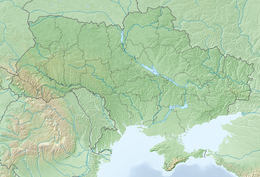
The Tendra Spit or Island of Tendra is a sandbar in the Black Sea and part of Kherson Oblast in Ukraine.
The island separates the Gulf of Tendra from the Black Sea and is located at the southern and western part of the bay. In the west the island has a spit called Bili Kuchuhury which, stretching east through the Gulf of Tendra as a shoal, reaches the Yahorlyk Kut peninsula. Bili Kuchuhury contains the Bili Kuchuhury Lighthouse.
The Tendra Lighthouse is also on the island.
History
[edit]The Battle of Tendra took place on 8 and 9 September 1790.
The mutiny of men on board the Russian battleship Potemkin took place off Tendra Spit in June 1905.
During the Russian invasion of Ukraine, on the night of 28 February 2024, Ukrainian Special Operations Forces troops from 73rd Maritime Special Operations Center attempted to make a landing on the sandbar. They were ambushed by the Russian troops and sustained heavy casualties. According to the Russian MOD, 4 boats out of 5 were destroyed or sunk and up to 25 Ukrainian soldiers were killed. One Ukrainian soldier was captured.[1][2][3][4]
On 7 August 2024, Ukraine announced that it had conducted another raid on the Tendra Spit.[5]
Ancient History
[edit]In classical times, the spit was known as "Achilles' Racecourse" Strabo (2024). Geography. Princeton. pp. 307 C, 28-308 C, 5. ISBN 9780691243139.
See also
[edit]References
[edit]- ^ "Что известно о гибели бойцов элитного украинского спецназа на Тендровской косе". BBC News Русская служба (in Russian). 2024-02-29. Retrieved 2024-02-29.
- ^ Суворов, Андрей (2024-02-29). ""Черный день" украинских ССО. Что известно о разгроме элитного спецназа в Херсонской области". Главные новости в России и мире - RTVI (in Russian). Retrieved 2024-02-29.
- ^ "Группа украинских диверсантов уничтожена при попытке высадиться в районе Тендровской косы". Interfax.ru (in Russian). 2024-02-29. Retrieved 2024-02-29.
- ^ "ВСУ сообщили о гибели военных 73-го морского центра спецопераций. В Минобороны РФ заявили, что в Херсонской области были убиты 25 "украинских диверсантов"". Meduza (in Russian). Retrieved 2024-02-29.
- ^ "Ukraine says it raided Russian-controlled spit in Black Sea". Reuters. 7 August 2024. Retrieved 10 August 2024.
External links
[edit]- Tendra Spit at the Encyclopedia of Ukraine
- Photos of Tendra Spit at May 2016

