Paterswolde | |
|---|---|
 Mansion Vennebroek in 2004 | |
 Paterswolde Location in the province of Drenthe in the Netherlands  Paterswolde Paterswolde (Netherlands) | |
| Coordinates: 53°9′N 6°34′E / 53.150°N 6.567°E | |
| Country | Netherlands |
| Province | Drenthe, Groningen |
| Municipality | Tynaarlo, Groningen |
| Area | |
• Total | 6.89 km2 (2.66 sq mi) |
| Elevation | 2.6 m (8.5 ft) |
| Population (2021)[1] | |
• Total | 3,795 |
| • Density | 550/km2 (1,400/sq mi) |
| Time zone | UTC+1 (CET) |
| • Summer (DST) | UTC+2 (CEST) |
| Postal code | 9765[1] |
| Dialing code | 050 |
Paterswolde is a village in the Dutch province of Drenthe. It is a part of the municipality of Tynaarlo, and lies about 8 km south of city of Groningen. Paterswolde and Eelde has merged into a single urban area, and are often referred to as Eelde-Paterswolde, however they remain separate villages.[3]
A small part of the village, on the south end of the lake Paterwoldsemeer, lies in the province of Groningen, in the municipality of Groningen.
History
[edit]The village was first mentioned in 1408 as Potterwolt, and means "the woods of Potter (person)".[4] Paterswolde is a road village from the Early Middle Ages which started to develop when peat was excavation in the nearby raised bog.[5]
During the 18th and 19th century, villas and estates were built in Paterswolde mainly by nobility and industrialists from the city of Groningen.[5]
Paterswolde was home to 795 people in 1840.[3] The Paterwoldsemeer and the Friesche Veen became a water sports and recreational area during the 20th century. Between 1955 and 1956, the Assumption of Mary Church was built in Paterswolde.[5]
Gallery
[edit]-
 Assumption of Mary Church
 -
 Villa in Paterswolde
 -
 Roundabout art
 -
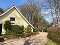 House in Paterswolde


References
[edit]- ^ a b c "Kerncijfers wijken en buurten 2021". Central Bureau of Statistics. Retrieved 12 April 2022.
- ^ "Postcodetool for 9765AA". Actueel Hoogtebestand Nederland (in Dutch). Het Waterschapshuis. Retrieved 12 April 2022.
- ^ a b "Eelde-Paterswolde". Plaatsengids (in Dutch). Retrieved 12 April 2022.
- ^ "Paterswolde - (geografische naam)". Etymologiebank (in Dutch). Retrieved 12 April 2022.
- ^ a b c Ronald Stenvert (2001). Paterswolde (in Dutch). Zwolle: Waanders. ISBN 90 400 9454 3. Retrieved 12 April 2022.
External links
[edit] Media related to Paterswolde at Wikimedia Commons
| International | |
|---|---|
| National | |
This Drenthe location article is a stub. You can help Wikipedia by expanding it. |